 Businesses are losing out on millions in savings by not using the best quality mapping data in their route management systems, according to independent research by Frost & Sullivan. These findings could prove highly significant as companies seek a competitive advantage to help recoup spiralling overheads, improve efficiency and grow their customer base.
The study, based on interviews with organisations across the public and private sectors, highlights the added value of using Ordnance Survey data for vehicle management. Using data from the national mapping agency saw up to a 28% improvement in productivity and a 5% increase in profitability, a marked improvement over mapping from alternative sources.
Chris Pearson, Ordnance Survey’s Sector Manager for transport says: “Consistent road network data and comprehensive addressing information are the twin tools that can improve fleet management. There are real advantages to be had by routing vehicles in the best way and knowing exactly where your customers are.
“Merely tracking the whereabouts of a vehicle or using an off-the-shelf satnav device will not reap the sort of benefits that Frost & Sullivan have discovered. We would encourage the industry to use the best quality mapping data in the systems they use.”
With only 14% of vehicles benefiting from using intelligent mapping data, there will be many operators delivering Internet shopping this Christmas missing out on potential savings.
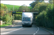
Pearson argues that accuracy and currency are key: “Postcodes can often cover a group of premises. That is why our data includes the location of individual business and residential properties, even those without an actual address. When used in combination with our road network, with coverage of every weight, width and height restricted road in the country, this information can greatly improve route management. This makes it possible to offer customers specific delivery times – something which benefits everyone.”
Frost & Sullivan spoke to customers of Ordnance Survey’s transport and addressing data, as well as those who take information from other providers. All reported benefits of using mapping data to underpin planning and logistics, but the level of detail and consistency set Ordnance Survey apart.
Scottish Water, which operates a fleet of 450 light commercial vehicles underpinned with Ordnance Survey data, commented: “Address information is relevant not only for our routing and planning but also for our customer service. Customer complaints have decreased significantly.”
They also noted that: “Advanced mapping data provides opportunities for fuel savings through monitoring journey routes, reducing speeding for duty of care and reducing vehicle idle times.”
Similarly, risk assessment and security experts Contract Fire Security commented on the consistency of Ordnance Survey data: “Although engineers know their areas, there is big potential in time savings through efficient routing. A number of our sites are very remote, therefore map detail and accuracy are critical.”
Ordnance Survey’s transport and addressing datasets are a part of OS MasterMap, the largest and most detailed geographic database in the world. With 27 million addresses and 740,000 named road links, it can form the bedrock of fleet management systems that deliver reliable scheduling, a reduction in failed deliveries and efficiency gains in fuel usage and fleet size.
Ordnance Survey
Tel: 08456 050505
www.ordnancesurvey.co.uk


Comments are closed.